From Kaohsiung Station to 85 Sky Tower: Using SimLens to Predict the Compression of a Telephoto Cityscape
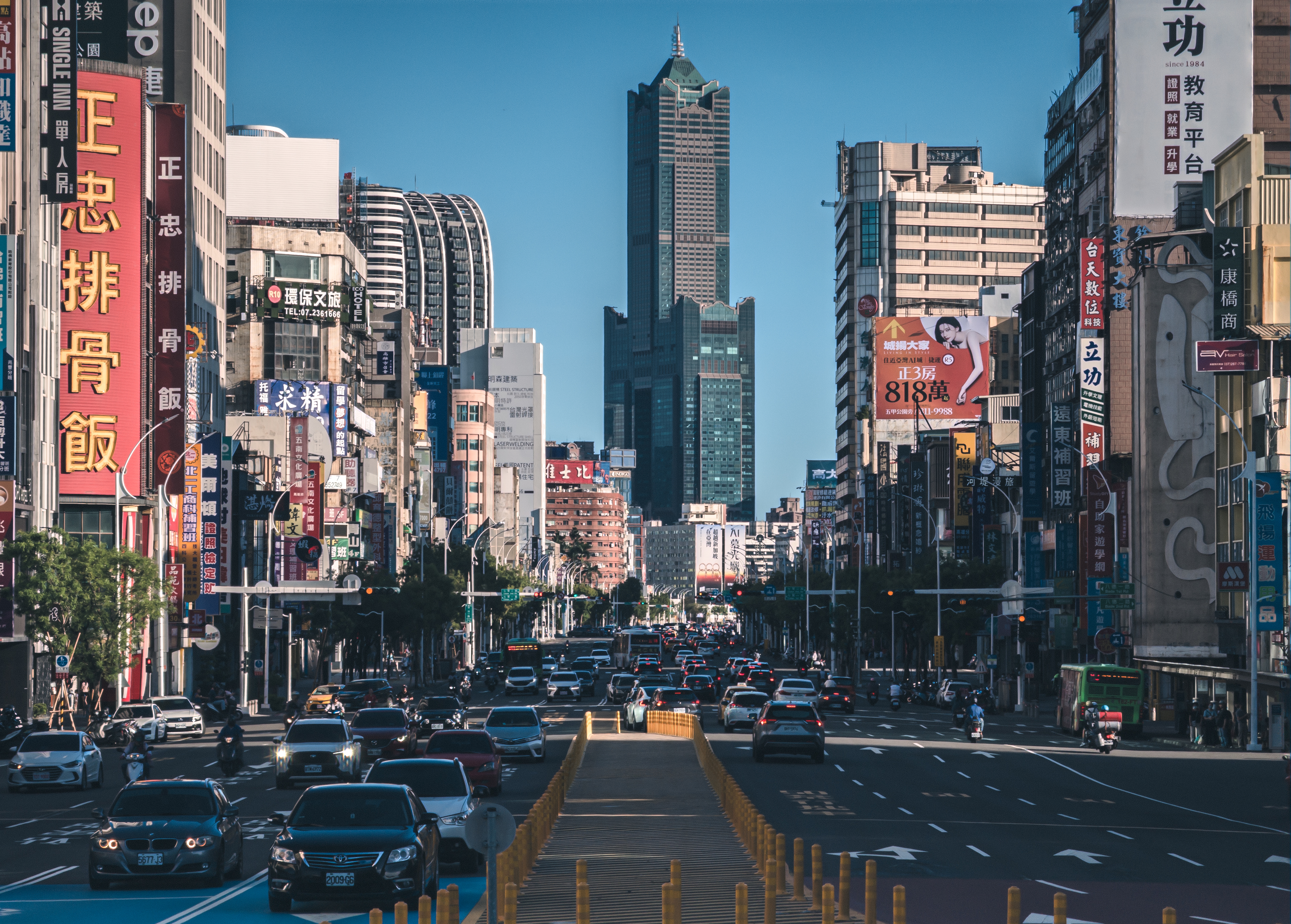
This photo was taken near Kaohsiung Station, looking toward 85 Sky Tower. What makes the image especially compelling is how the tower appears near the center of the road axis, framed by dense signs, commercial buildings, and traffic on both sides. Although the shooting location is actually quite far from 85 Sky Tower, the telephoto perspective visually pulls the distant landmark closer, compressing the depth of the street into a strong directional corridor.
The key to this kind of photo is not simply “being able to see the landmark,” but making sure the landmark has enough visual weight in the frame. With a wide-angle lens, 85 Sky Tower would likely become a small element in the distance and lose its presence as the main subject. By using a telephoto focal length around 120mm, the foreground traffic, street signs, buildings, and distant skyscraper become visually compressed, making the layers of the city feel denser and more dramatic. This is one of the most fascinating aspects of telephoto urban photography: it can reorganize scattered everyday scenery into a much stronger composition.
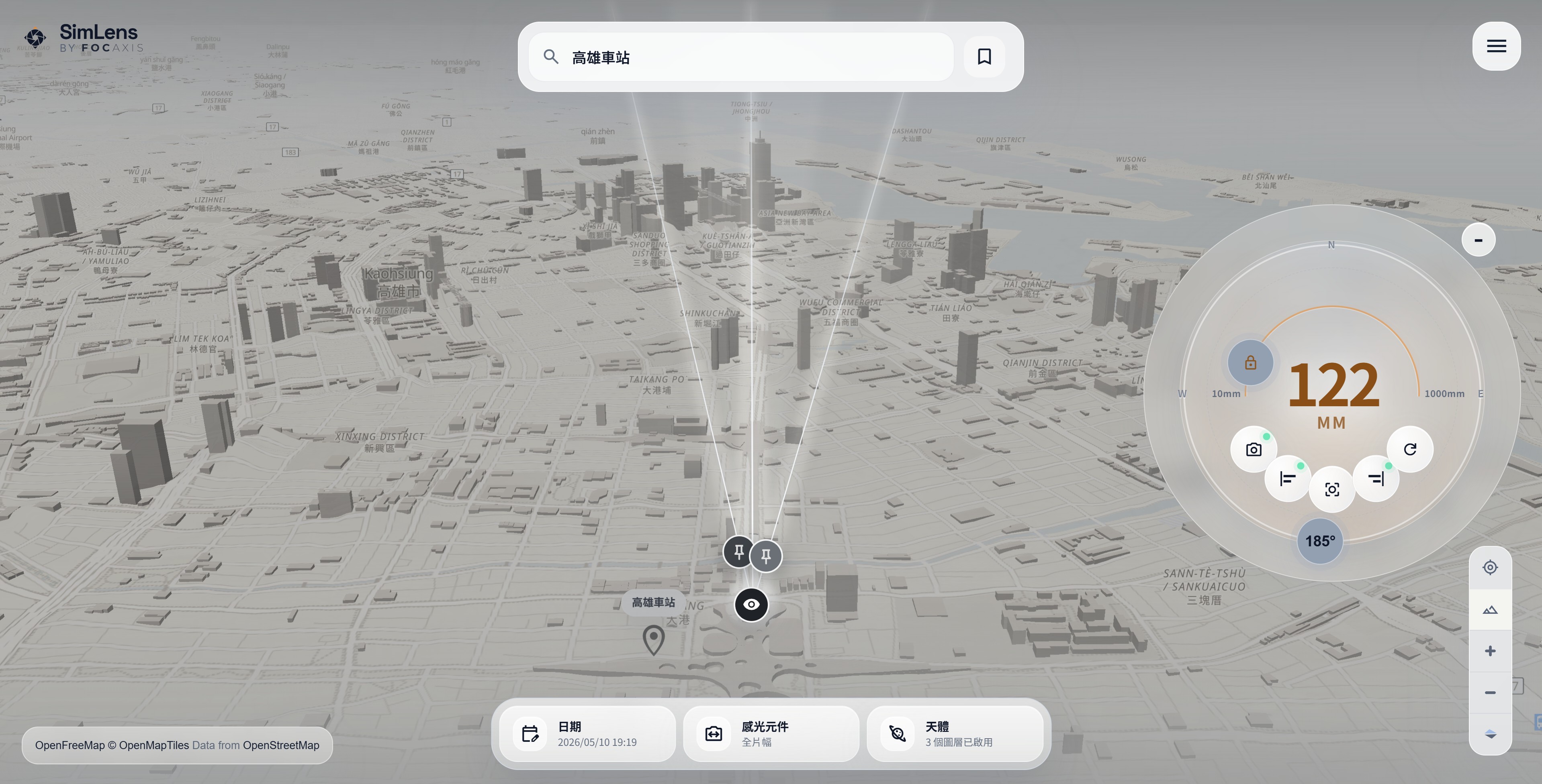
In the SimLens simulation, the viewpoint near Kaohsiung Station is aimed south toward 85 Sky Tower, with the simulated focal length landing at around 122mm. This matches the feeling of the real photo quite well: 85 Sky Tower is not so large that it overwhelms the entire frame, but it is prominent enough to serve as the distant visual anchor. At the same time, the road, surrounding buildings, and skyline still preserve the context of the city. With this approach, you can estimate where to stand, which direction to face, and what focal length to use before arriving on location, instead of discovering on-site that the lens is too wide, the landmark is too small, or the alignment is slightly off.
This case is also a good example of what SimLens is designed for. It is not just a map tool; it turns photographic composition into a spatial relationship that can be simulated in advance. When planning shots of distant landmarks, urban axes, mountains, bridges, or sunset alignments, focal length often determines the story of the image. By using SimLens to preview the angle of view and focal length beforehand, photographers can plan their gear and shooting position with much more confidence, turning what used to be trial and error on location into a more precise shooting plan.